
Where to live in Miami: A neighborhood guide for everyday life |
Compare Brickell, Downtown, Coconut Grove, Little Havana, and Little Haiti, plus nearby cities, through housing, errands, parks, and the journeys you’ll make most. |
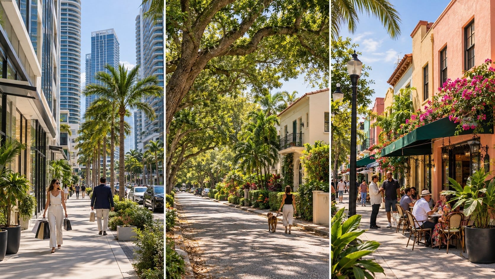
By Mingo, Chief Honking Officer of The Miami Honk
Choosing where to live in Miami gets easier when you picture a Tuesday. You need groceries after work, somewhere to stretch your legs, and a way home that still feels reasonable when it rains.
Mingo here. A waterfront view can certainly join the shortlist. Give the trip to the supermarket an equally fair hearing.
This guide compares five City of Miami neighborhoods through housing, errands, evening activity, green space, and transportation. Nearby municipalities get their own section, with the city boundaries kept clear. |
1. Start with the shape of your week |
Put your workplace, regular appointments, and preferred grocery store on a map before you fall for a balcony. If school or childcare is part of your routine, add those addresses, too.
These five neighborhoods are within the City of Miami. The nearby municipalities later in this guide have their own local governments. Neighborhood boundaries and listing labels can vary, so verify the actual address.
|
2. Brickell: tower living with useful connections |
Brickell deserves a look if you want an apartment near offices, restaurants, and rail. High-rise rentals and condos are central to the housing search here.
The shopping and dining around South Miami Avenue, Mary Brickell Village, and Brickell City Centre can put several errands on foot. Check where you’d buy a full week’s groceries, collect prescriptions, and handle laundry if the unit has no washer.
Brickell station connects Metrorail and Metromover. The free Metromover serves Brickell, Downtown, and Omni, which makes it useful when your regular destinations line up with its stations.
Evenings bring plenty of restaurant and bar activity around the commercial core. Visit the actual unit at the hour you expect to sleep. Traffic below the balcony can sound quite different once the apartment tour’s cheerful conversation stops.
For a green-space stop, Simpson Park protects a small hardwood hammock at the neighborhood’s edge. Check opening times and rules before making it part of a daily routine.
During a viewing: Time the journey from the unit to the sidewalk. Ask about elevator waits, visitor parking, package handling, and any separate parking charge. A short walk to work loses some sparkle if collecting the car becomes an expedition. |
3. Downtown: choose the block as carefully as the building |
For this guide, Downtown means the core north of the Miami River. Brickell gets its own section, even though broader “Greater Downtown” descriptions often include both.
Expect a housing search centered on apartment and condo buildings, with some loft-style options. Compare the immediate surroundings: a tower near Government Center offers a different starting point for your day from one facing the bay.
Metrorail and Metromover connect at Government Center. Map the station you’d actually use and walk the route to it. The county’s rail network can be helpful, but it won’t put every workplace within an easy trip.
Bayfront Park and Maurice A. Ferré Park give the area important bayfront outdoor spaces. Museums, performances, waterfront attractions, and arena events add reasons to head out after work. They can also change traffic and the feel of surrounding streets.
Run ordinary errands during your visit. Locate a supermarket that carries your staples, check its hours, and see how you’ll get the shopping upstairs.
Pay attention to: Loading areas, construction, garage entrances, and the route home after dark. Ask neighbors or building staff how event days affect access. A neighborhood name can’t answer those questions for a particular doorway. |
4. Coconut Grove: leafy streets, a village center, and bayfront parks |
Coconut Grove offers a broader housing mix, from detached houses and townhouses to apartments and waterfront condos. Prices and maintenance responsibilities vary across that mix.
The commercial center around Main Highway, Grand Avenue, and McFarlane Road brings cafés, shops, and restaurants together. A home near that cluster can support several errands on foot. A listing elsewhere in the Grove needs its own grocery and pharmacy check.
Outdoor space is a substantial part of the appeal. Peacock Park, at 2820 McFarlane Road, sits close to the village center. David T. Kennedy Park offers another bayfront option along South Bayshore Drive.
Restaurants and outdoor tables give the center evening activity. Walk a few residential streets as well as the dining strip so your impression includes the part of the Grove where you might live.
The neighborhood’s Bahamian and Black history is part of its identity. Approach established residential streets as someone considering joining a community.
Mind the station gap: Coconut Grove Metrorail station is on SW 27th Avenue near US 1, away from the village waterfront. Test the full walk or connecting ride. A station with the neighborhood’s name doesn’t promise a short stroll from every home.
Shade can make a walk feel inviting here. Check crossings and sidewalk continuity with the same care, especially if you’ll use a stroller or mobility aid. |
5. Little Havana: daily businesses beyond the visitor circuit |
Little Havana rewards a search that takes you beyond Calle Ocho’s most photographed stretch. Housing includes older houses, smaller apartment buildings, and newer rental developments. Compare the condition and management of each property.
Cuban cultural institutions, cafés, food shops, and other Latin American businesses shape the area’s street life. Calle Ocho is a useful orientation point, with dining and music venues that can keep parts of the corridor active into the evening.
For a prospective home, walk the nearest shopping streets and locate your actual essentials. Check the full supermarket trip, pharmacy hours, and laundry arrangements. A convenient coffee window is a lovely bonus. You’ll still need somewhere to buy washing detergent.
José Martí Park, at 362 SW 4th Street on the eastern side of the area, has waterfront space and recreation facilities. Check the distance from each home you’re considering; Little Havana covers more ground than a sightseeing stop suggests.
Travel within the neighborhood relies on walking, buses, local trolley services, or driving according to the address and destination. Consult the City of Miami trolley information and current county routes. Don’t assume a direct rail trip from your door.
On your visit: Check street parking at night, trash arrangements, air conditioning, and sound through the walls. Ask which repairs the landlord handles and whether the advertised rent includes any utilities. |
6. Little Haiti: cultural anchors and a street-by-street search |
Little Haiti’s cultural institutions offer a starting point for getting to know the neighborhood. The Little Haiti Cultural Complex, at 212–260 NE 59th Terrace, and Libreri Mapou help connect visitors with its arts and community life.
For housing, investigate houses, duplexes, and low-rise apartments. Listing labels around Little Haiti and neighboring areas aren’t always consistent. Confirm the address and walk its surroundings.
NE 2nd Avenue is an important local corridor, but the nearest café or cultural venue won’t tell you whether weekly shopping is convenient. Locate the supermarket, pharmacy, and services you’ll use, then test the routes between them.
Little Haiti Soccer Park, at 6301 NE 2nd Avenue, provides sports and recreation facilities. Check which spaces and programs match your interests and when they’re available.
Evening activity depends on the block and event calendar. Visit on a normal weeknight as well as a day with a cultural event. Those visits answer different questions.
Plan the connection: There’s no Metrorail or Metromover station in the neighborhood’s core. Check the exact bus or trolley route, waiting time, and return service before relying on transit for work.
If you prefer a low-rise home and want to support local businesses, include the area in your visits. Give existing neighbors the courtesy of learning the community beyond real-estate descriptions. |
7. Nearby municipalities: separate cities worth comparing |
These places belong on some Miami-area shortlists, but they’re separate municipalities. Verify local services, permits, and resident programs with the appropriate city. Coral Gables: a commercial center surrounded by residential streets
The city’s free trolley connects parts of Coral Gables with Douglas Road Metrorail station. Check the current route and service days. The published regular schedule excludes Sundays and certain holidays, which matters if you expect to use it every day.
Explore nearby parks and green space from the actual property. A tree-lined drive makes a pleasant first impression, but shade alone won’t shorten the school run. Miami Beach: compare South Beach, Mid Beach, and North Beach
Miami Beach has its own neighborhoods and a housing mix that includes older low-rise apartments, condo towers, and detached houses in selected areas. Inspect the building and its rules carefully, especially if you’re comparing an older apartment with a newer condo.
South Beach, Mid Beach, and North Beach can produce quite different routines. Walk the route to groceries, public beach access, and the nearest useful park. Return in the evening to assess the specific street.
The city operates its own free trolley network. Metrorail and Metromover don’t directly serve Miami Beach, so a mainland commute needs a tested bus, driving, or other connection across the causeways.
Include parking permissions, storm planning, and access during busy periods in your checks. Easy beach access is a pleasure you can use often; make sure the rest of the week works, too. South Miami: a smaller downtown with a Metrorail station
The City of South Miami is distinct from both the City of Miami and the broad phrase “south Miami.” Its downtown around Sunset Drive has restaurants and shops near South Miami Metrorail station.
Compare apartments or condos near the commercial center with houses on surrounding residential streets. Test the walk across major roads, and map the grocery store you’ll actually use.
Dante Fascell Park is one local green-space option. Check distances from your shortlist and the availability or fees for any activities you plan to use.
For someone whose work or regular appointments follow the Metrorail corridor, the station is a useful reason to investigate. Add waiting time and the final connection to every journey estimate. |
8. Compare the whole housing bill and your household’s routine |
Use live listings for comparable homes with the same bedroom count and similar condition. Check the lease length and whether a promotional rent changes after an initial period.
For a rental, total the monthly rent, parking, utilities, pet charges, and recurring building fees. Keep deposits, applications, and moving charges in a separate upfront total.
For a purchase, include association dues where applicable, taxes, insurance, maintenance, and any assessments. Review condo budgets, reserves, and applicable inspection documents before making a decision.
If you have children: Verify school assignment and enrollment requirements using the exact address. Add childcare, pickup arrangements, and a playground you can reach on a working day.
If you work from home: Test mobile reception, confirm available internet services, and listen from the room where you’ll take calls. A delivery area beneath the window can become surprisingly familiar.
If you’ll live without a car: Rehearse the grocery trip, evening return, and a journey beyond your usual commute. Budget for occasional paid rides where the network doesn’t suit your plans.
For every address, check storm surge planning information and flood-zone maps. These serve different purposes. Ask about building and garage flooding, storm protection, and insurance for the property.
No neighborhood name guarantees quiet, affordability, or a particular level of personal safety. Observe the block at different times, consult relevant public information, and ask specific questions about building access and local conditions. |
9. Ask these questions during a neighborhood visit |
Give each serious contender an ordinary weekday. Begin at the property, complete a real errand, and return after dark if that reflects your normal schedule.
Carry your shopping home and wait for the bus you’d use. Notice where afternoon sun heats the pavement. Near the property, pause long enough to hear the street settle back into its normal sounds.
Pick two or three areas to revisit, then compare the actual homes you can afford. Keep notes on the compromises you can live with and the details you’d enjoy every week.
For utilities, driving paperwork, and the wider relocation checklist, read Moving to Miami: What to know before you pack.
And when you’ve found your corner of the city, The Miami Honk will help you keep getting to know it.
See you around town,
Mingo | Chief Honking Officer | The Miami Honk |
5 Comments
Join the conversation
Nice to see someone actually talking about green space and transportation together. Most of these Miami guides just focus on nightlife and restaurants and call it a day.
Curious which five neighborhoods made the cut. Hoping Little Havana and Allapattah are in there since they get overlooked a lot compared to the flashier spots.
The Tuesday scenario is so real lol. I moved to Brickell thinking it would be convenient and then realized my nearest supermarket was a 20 minute walk in the heat. Learned that lesson the hard way.
tiffany_wBrickell is so deceptive because everything looks walkable on the map and then you step outside in August. The heat just changes the whole math on distance.
Really helpful breakdown. I always tell people the grocery store test is the first thing to check when moving somewhere new. Glad someone finally wrote about it this way.